


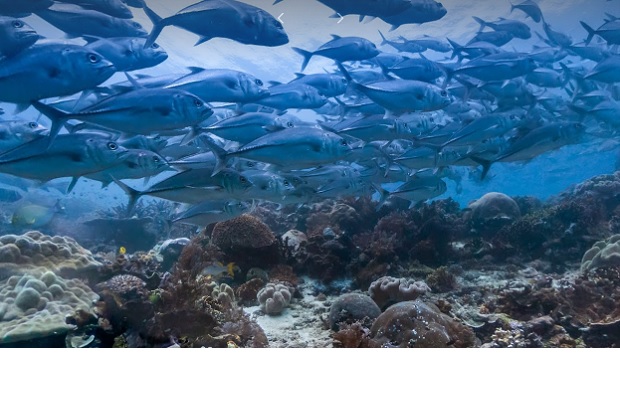
Google has released a batch of 40 Street View images with a twist- they are all underwater views.
As well as regular images, the new views let you swim with humpback whales in the Cook Islands, dive off the coast of Bali and take a beach stroll in Samoa.
Google’s Street View team created the new pictures alongside the Catlin Seaview Survey, the Office of National Marine Sanctuaries and the Chagos Conversation Trust.
The project was done in partnership with XL Catlin Seaview Survey, NOAA’s Office of National Marine Sanctuaries and the Chagos Conservation Trust, in conjunction with World Oceans Day on Monday, according to a Google blog post.
Google released its first underwater panoramic images to Google Maps in 2012. It is part of Google Earth Outreach, set up to help monitor the conditions of some of Earth’s most remote and breathtaking habitats.
“Each image in Google Maps is a GPS-located digital record of these underwater and coastal environments, which can be used as a baseline to monitor change over time,” the post states. “This comprehensive record of coral reefs showcases the beauty of these ecosystems and highlights the threats they face, such as the impact of increasing storms in the Great Barrier Reef and of rising water temperatures, factors causing the reefs to bleach white.
