

Google is updating its mapping service with 3D technology, as the internet giant looks to counter Apple’s decision to drop its service from its iPhone and iPads.

The new service will offer zoomable, three-dimensional cityscapes, complete with top and side level views of buildings, streets and landscaping.
The new features include 3D enhancements to Google Earth, a portable device for taking “street view” panoramic photos and offline access to Google Maps on Android phones.
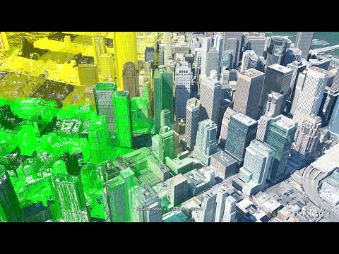
Google Imagery, the company’s most sophisticated 3D rendering to date, makes use of an automated process to generate very detailed models from 45-degree aerial photos.
Google commissioned a fleet of planes to source the mapping data.
Fly-over views of San Francisco’s Civic Center, City Hall, AT&T Ballpark and waterfront were shown during Wednesday’s demonstration.
Google Maps has established itself as the global market leader for mapping technology, attracting one billion users. However, the company has recently seen defections by some key developers and partners.
Reports suggest Apple may abandon Google Maps next week at its annual developer conference.
They suggest Apple may announce its own mapping application to replace Google Maps on its smartphones and tablets.
Google aims to launch the service later this year.
Watch a video demonstrating how the service works here:
Read the official Google blog here
